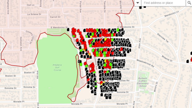
Los Angeles County has released preliminary maps that indicate which homes and structures have been damaged or destroyed, although access to many areas in the Eaton and Palisades fire zones is still prohibited.
Los Angeles County Sheriff Robert Luna reported that more than 92,000 residents were still under evacuation orders as of Monday.
Although they are still unfinished, the maps provide evacuees a chance to check whether their house is still intact or how much damage has been done. Many locals are still unable to go back to their communities.
“Repopulation will not occur until all areas are safe,” stated Anthony Marrone, the chief of the Los Angeles County Fire Department.
The color-coded maps display evaluations of the damage to the structures, ranging from destroyed to severe and minor damage, as well as those that have been affected and those that have not.
The maps are updated every day, according to Marrone, who also mentioned that “if there is not a color icon on your address, it means the building has not yet been inspected.”
Echoing Marrone, Luna stated that repopulation is of utmost importance.
“We are hearing our community loud and clear and we want to get you in there as soon as possible,” he stated.
According to him, teams are still trying to find the deceased, and there are still many dangers in the region.
“For the Altadena area, we are in the third day of grid searching,” Luna stated. “It’s a really depressing task… ‘I simply want to go look at my house and see what’s left,’ some folks say. We are aware of it, but there are individuals here who are actually searching for your neighbors’ bodies. We ask for your patience.
