
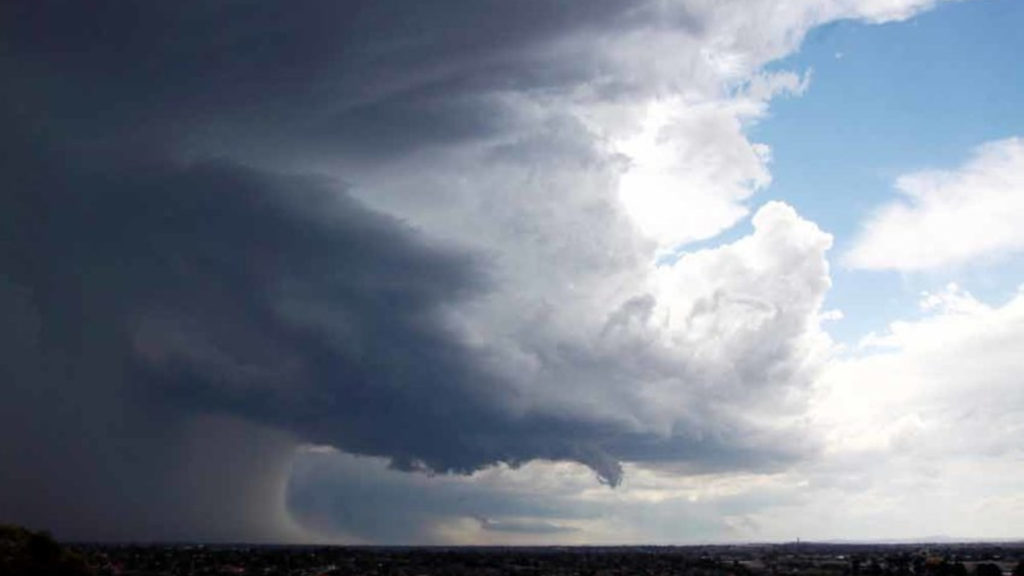
A powerful storm system is expected to sweep through the United States in the coming days, bringing with it the risk of severe weather, including hail and strong winds. The storm, which has developed over the central U.S., is projected to impact up to seven states in the South and Southeast.
Residents across the affected areas are being urged to prepare for potentially dangerous weather conditions that could include hailstones up to 1 inch in diameter.
States in the Storm’s Path
The new storm will primarily affect the following states:
- Texas
- Arkansas
- Louisiana
- Mississippi
- Tennessee
- Alabama
- Georgia
Each of these states will likely experience severe thunderstorms, which could include hail, high winds, and heavy rain. The storm is expected to develop further as it moves southeastward, intensifying over time, and may bring additional severe weather concerns as it progresses.
For residents in these states, it’s crucial to stay informed and take the necessary precautions to safeguard lives and property.
The Timeline: When to Expect the Worst
The National Weather Service (NWS) and the Storm Prediction Center (SPC) have forecasted the storm’s progression across the region. Initially, the system will form over the central U.S., moving toward the southeastern states with increasing intensity.
While specific timing may vary, experts predict that severe weather could begin as early as late afternoon or early evening and continue overnight in some areas. The most significant hail and wind gusts are expected during the storm’s peak, which will likely occur in the evening hours.
Local meteorologists recommend that individuals in the affected states monitor their local news and weather apps for up-to-date alerts. Storms of this magnitude can change quickly, so real-time information will be vital for making informed decisions on how to stay safe.
What Are the Major Risks?
The primary hazards associated with this storm are hail and strong winds. Hailstones as large as 1 inch in diameter are expected to be the norm, though some regions may see larger hail. These conditions can lead to property damage, particularly to vehicles, roofs, and windows.
Wind gusts could also reach speeds of 60-70 mph, which may cause tree damage, power outages, and scattered debris. Heavy rain and possible flash flooding are additional concerns in some areas, especially where the storm lingers for an extended period.
It’s essential for individuals in these areas to understand the risks involved, as hail can cause significant damage to homes and vehicles, and high winds can make driving hazardous.
How to Prepare for Severe Weather
For those living in areas that may be impacted by the storm, the following preparations can help minimize the risks associated with hail, wind, and heavy rain:
- Protect Vehicles: If you have access to a garage or carport, it’s wise to move your car inside to avoid hail damage. If this is not possible, try to cover your vehicle with a thick blanket or tarp to reduce damage.
- Secure Outdoor Items: Strong winds can send outdoor furniture, garden tools, and other loose items flying, potentially causing injury or property damage. Bring these items indoors if possible, or secure them in a sheltered area.
- Stay Indoors During the Storm: The most important safety measure during severe storms is to stay indoors, away from windows and exterior walls. If a tornado warning is issued, move to a basement or interior room on the lowest level of your home.
- Emergency Kit: Ensure you have an emergency kit on hand that includes flashlights, batteries, a first-aid kit, and bottled water. Power outages can sometimes last for hours or even days, so it’s essential to be prepared.
Storm Tracking: Resources for the Latest Updates
As the storm approaches, it’s important to stay updated on its path and severity. Several resources can provide real-time information on the storm’s progress and help residents make decisions about when to take shelter:
- National Weather Service (NWS): The NWS will issue official storm warnings, including advisories about hail, wind, and flash flooding. Visit weather.gov for live updates.
- Storm Prediction Center (SPC): The SPC is closely monitoring the storm’s development and will provide regular updates on the likelihood of severe weather. Check out their website at spc.noaa.gov.
- Local News and Weather Apps: Local meteorologists are often the best source for immediate, location-specific weather alerts. Many weather apps also offer push notifications, allowing you to receive instant updates directly on your phone.
What To Do After the Storm
Once the storm passes, it’s crucial to remain cautious. Areas impacted by severe weather may experience downed trees and power lines, making it dangerous to go outside immediately after the storm.
- Check for Damage: Once it is safe to do so, inspect your property for hail damage or debris, and report downed power lines or trees to local authorities. Be sure to avoid driving unless absolutely necessary, as roads may still be hazardous.
- Monitor Flooding: In areas where flash flooding is a concern, avoid driving or walking through standing water. Even small amounts of moving water can be dangerous.
Conclusion: Staying Safe Amidst Severe Weather
As the storm system advances, residents in the impacted states must remain vigilant and prepared. While hail and wind damage may seem like a common occurrence, the severity of this storm could cause more significant disruptions.
By following the safety recommendations outlined above and staying informed through trusted resources like the NWS and SPC, individuals can minimize risks and stay safe during this storm event.
For more information and updates as the storm progresses, visit the National Weather Service at weather.gov.
Disclaimer – Our team has carefully fact-checked this article to make sure it’s accurate and free from any misinformation. We’re dedicated to keeping our content honest and reliable for our readers.