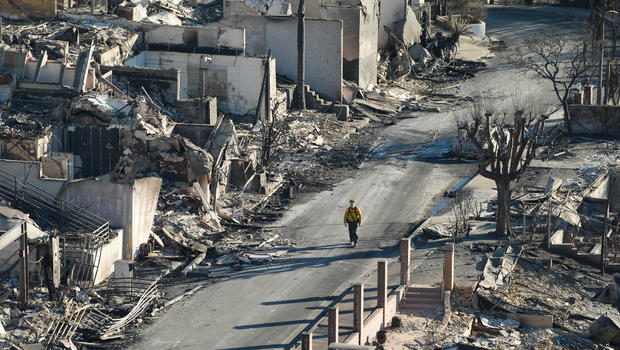
Firefighters are working in the midst of a particularly dangerous situation with red flag warning weather conditions as they attempt to control and suppress two wildfires in Southern California on Wednesday.
Destructive Santa Ana winds fanned the Palisades Fire in the coastal neighborhood of Pacific Palisades and the Eaton Fire in the northeastern part of the county near Pasadena just over a week ago on January 7. The PDS red flag warning is still in force till 3 p.m. on Wednesday in places like the mountains, valleys, and certain coastal towns.
The 14,117-acre Eaton Fire is 45% contained, and work to further confine it is “steadily progressing,” according to Cal Fire. According to the EPA, there are isolated heat pockets in some parts of the burn footprint where fuels are still burning out, while tactical patrols and mop-up activities are occurring in other locations.
The villages on the southern border of the fire are still undergoing assessments of hazardous materials, infrastructure and damage, and urban search and rescue operations. Before the evacuated neighborhoods can be repopulated, officials say these measures are crucial.
They are 19% contained in the 23,713-acre Palisades Fire, and firefighters “continue to aggressively engage in fire suppression.” The construction and reinforcement of containment lines around the fire’s footprint are still ongoing.
25 people have died as a result of the fires thus far. According to the California Department of Forestry and Fire Protection, both are currently among the top five most devastating fires the state of California has witnessed since records began to be kept in 1932.
Both fire sites continue to have mandatory evacuation orders in effect.
Preliminary maps of the Eaton and Palisades fire damage assessments have been made available by Los Angeles County. The maps are updated every day, according to officials. The color-coded maps display damaged, major, and minor structures, as well as those that have not been damaged. To access the maps, go to recovery.lacounty.gov.
