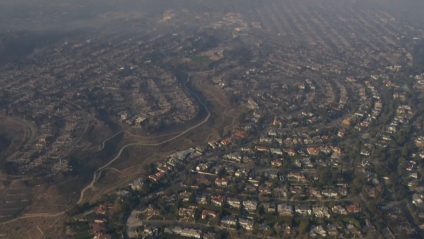
On Thursday, SkyCal provided an overhead view of some of the regions affected by the Palisades Fire by flying over a section of the Pacific Palisades.
In order to give some residents a chance to view their communities for the first time since the fire started on Tuesday morning and swiftly spread to cover around 20,000 acres by Thursday evening, a KCAL News photographer superimposed a street map.
SkyCal had planned to stay until the entire area could be seen, but they were had to go as yet another massive brushfire erupted in the Calabasas hills.
Plans are underway to return to the region in the upcoming days when visibility improves and conditions improve.
As soon as local flight restrictions are lifted, SkyCal also intends to give the Eaton Fireas the same chance.
