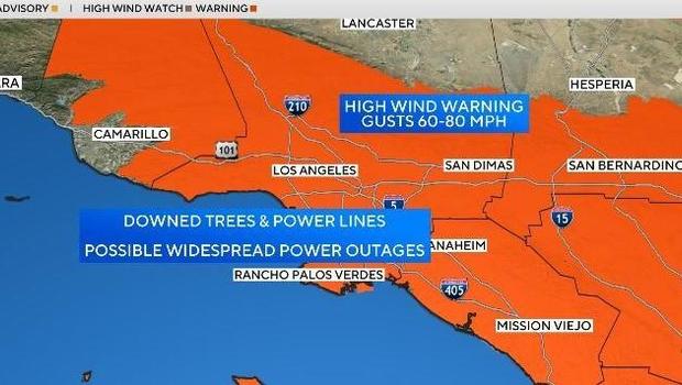
As a potentially deadly and catastrophic storm approaches, forecasters are referring to it as the strongest wind event of the season. The storm’s biggest effects are expected to be felt in the foothills, valleys, and mountains along the 210 and 118 corridors.
Peak wind conditions are predicted to arrive at 10 p.m. on Tuesday and last until 10 a.m. on Wednesday. According to the National Weather Service, such winds have not been observed since 2011.
“The strongest winds with this event are expected to be Tuesday afternoon into early Wednesday afternoon when widespread damaging wind gusts of 50 to 80 mph are likely,” the National Weather Service stated.
“The San Gabriel mountains, Santa Susana mountains, and foothills of the San Gabriel/San Fernando Valleys will likely see areas of destructive wind gusts between 80 and 100 mph.”
As the winds blow in from the mountains, down the canyons and passes, and eventually work their way down into the lower elevations, they will continue to get stronger throughout the evening, according to meteorologist Amber Lee of KCAL News.
Note: Every piece of content is rigorously reviewed by our team of experienced writers and editors to ensure its accuracy. Our writers use credible sources and adhere to strict fact-checking protocols to verify all claims and data before publication. If an error is identified, we promptly correct it and strive for transparency in all updates, feel free to reach out to us via email. We appreciate your trust and support!
